Explanation by Dr. Stokes
"The location of each view which appears in this collection may be identified using the two-part map of Natchitoches Parish which accompanies the photographs and is titled, "Location Map - Folk House Survey." The routes covered by the survey are marked with large dots placed along the roads on the map. The map is divided into a grid system in which squares are identified by number and letters."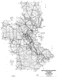
Dr. Stokes's original map is in two parts. It is shown here digitally stitched together.
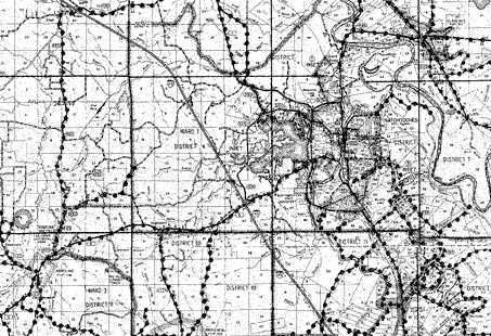
Close up view of Dr. Stokes's original map.
Stokes Collection home page | Dr. Stokes' description of the collection
View of map used by Dr. Stokes | House types with examples