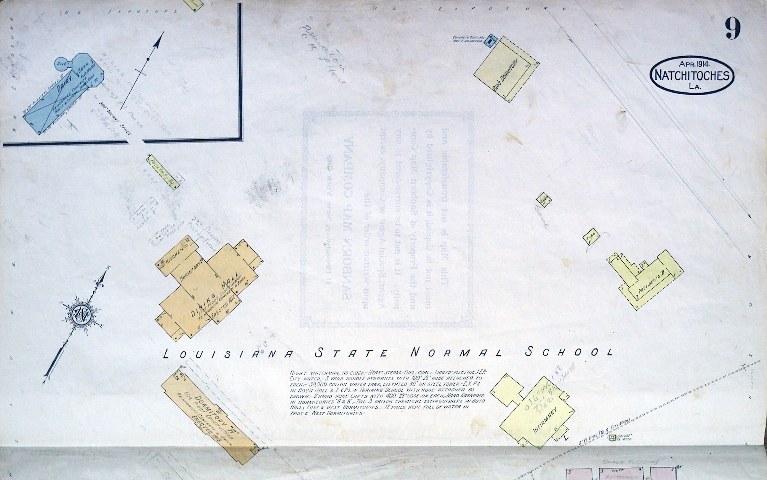
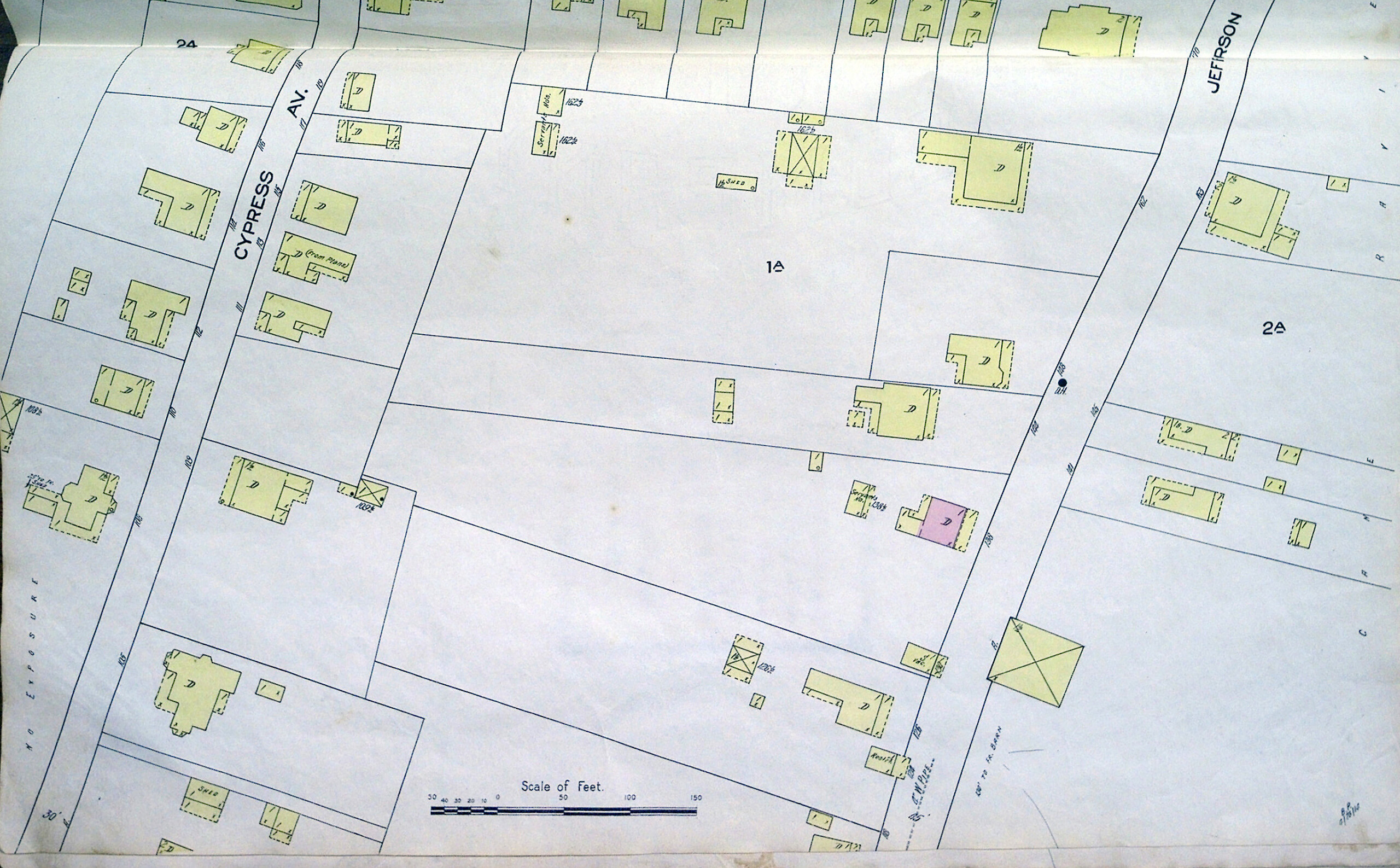
Sanborn Maps
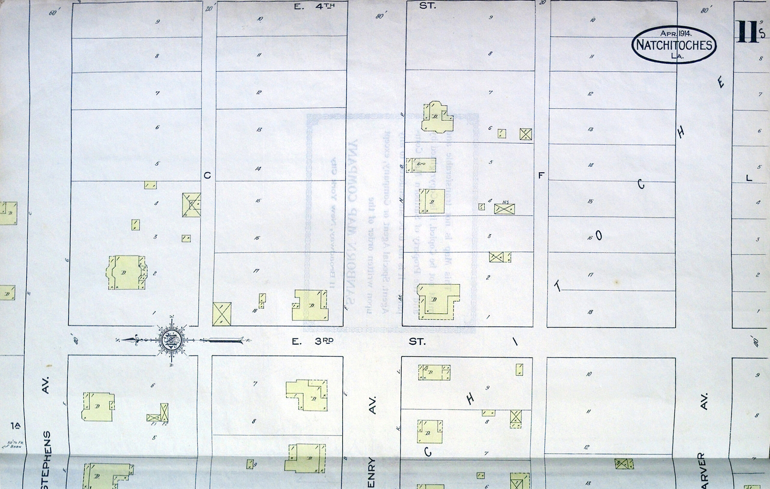
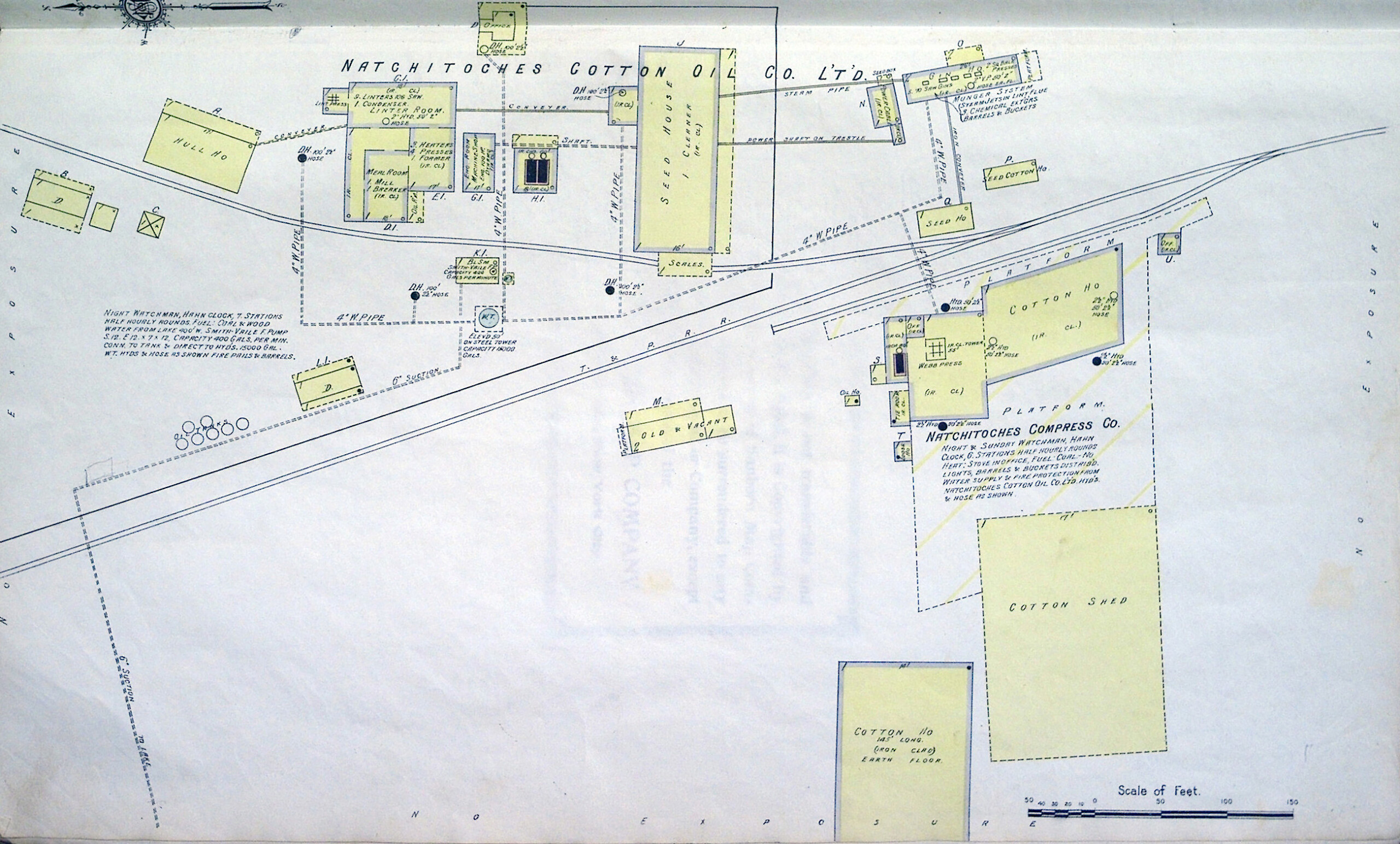
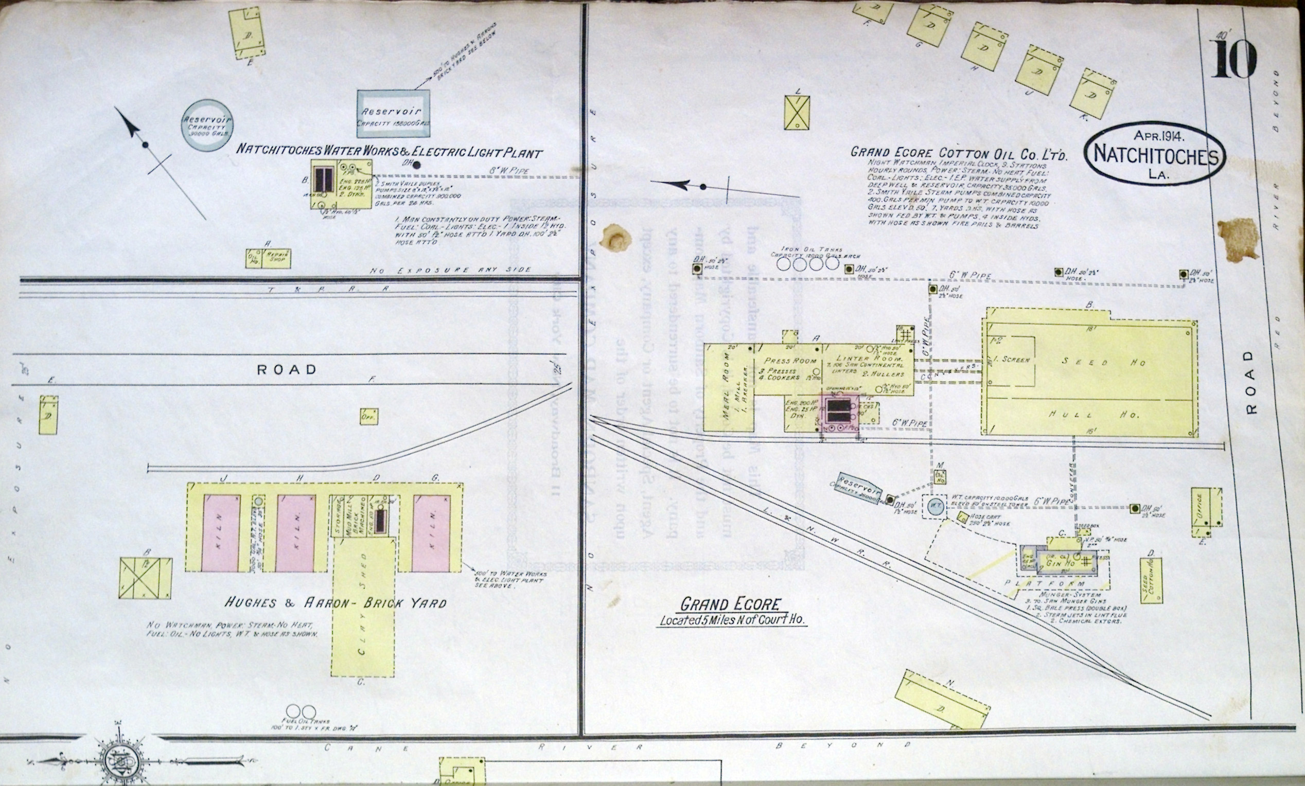
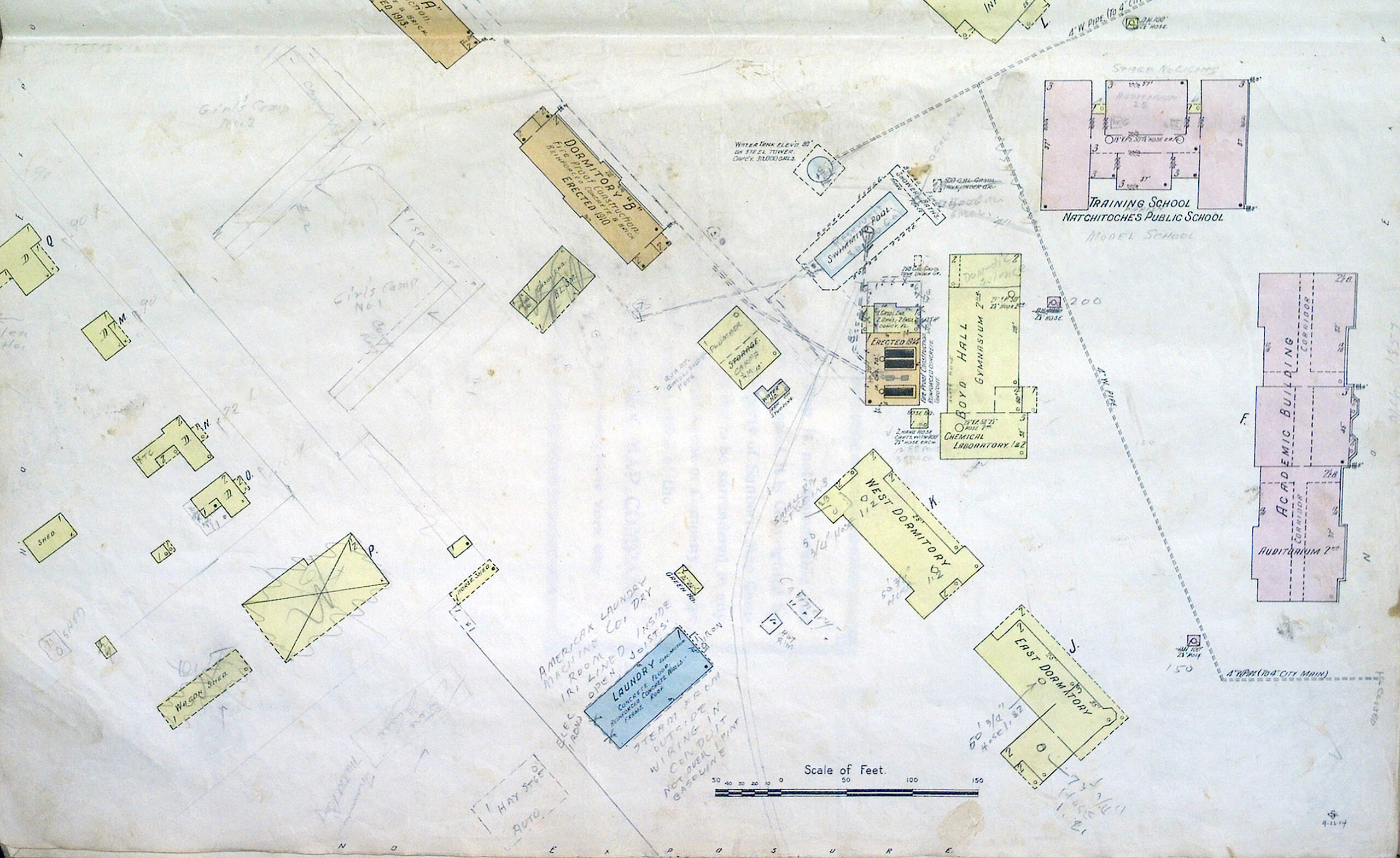
Sanborn Maps was a creator and publisher of maps of US cities and towns. The Sanborn Maps were originally created for assessing fire insurance liability in urbanized areas in the United States. The maps include detailed information about buildings in approximately 12,000 US towns and cities. The maps are invaluable for documenting changes in the built environment of American cities over many decades. They are a highly useful resource for historical research, planning, preservation, genealogical research, sociological studies and research of urban geography.
The last Sanborn fire maps were published on microfilm in 1977, after US insurance companies stopped using maps for underwriting.
— “Sanborn Maps.” Wikipedia, Wikimedia Foundation, 17 Oct. 2017, en.wikipedia.org/wiki/Sanborn_Maps.